The Geezers have started research on their project Where’s My Boozer Gone? At this point we are establishing pubs in Bow which have closed in the last 20-30 years.
We have got pictures for most of them which we have posted below.
Do you remember them? Did you socialise in them? Did you work in them?
Let us know about it. We are interested in your stories and memories for an exhibition we will be mounting at the Idea Store in the Roman Road and at other venues in the Borough.
We will also be producing a booklet.
Please send us your stories and comments in the Comment section at the bottom of the post or email: bowgeezers@btinternet.com
We are researching pub histories in the Local History and Archive Library in Bancroft Road.
Our next step is to do interviews with people who socialised or worked in the pubs. How important were they to individuals in the community and to the community as a whole?
Please let us know if you’ve got stories to tell. And we are still looking for pictures for
The Earl of Aberdeen – Grove Road now got this one – thanks to Kevin for sending us this link.
The Horns – LeFevre Road
The Lady Franklin – Old Ford photo now received, see below
The Royal Standard – Eric Street
The Marquis of Cornwallis
The Three Colts or Old Three Colts 450 Old Ford Road
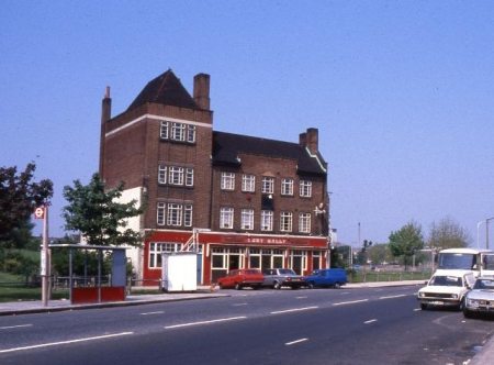
Here’s the pubs we’ve found so far:
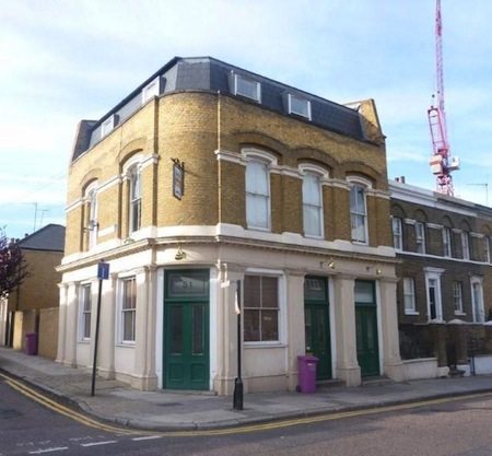
Caledonian Arms
Location of Pub- 62 Fairfield Road
Opened – 1851 Closed – 2000
Brewery? – Watney’s Brewery
What Is It Now? – Residential Use
Was it known by any other name?
What Activities Did Pub Used To Have?
Information so far
This former Watney’s Brewery pub had been present since at least 1851. It’s just north of the former Bryant & May match factory, scene of the famous ‘Match Girls’ strike of 1888. The statue of Prime Minister Gladstone is outside Bow Church. Despite the clean-up efforts of the local council, he usually has red hands to symbolise his role in the ending of the strike which was said to have been “paid for in blood”. This pub must have been witness to many of the events of the time. It closed in 2000 and stood derelict for a long time, but has now been converted to residential use.
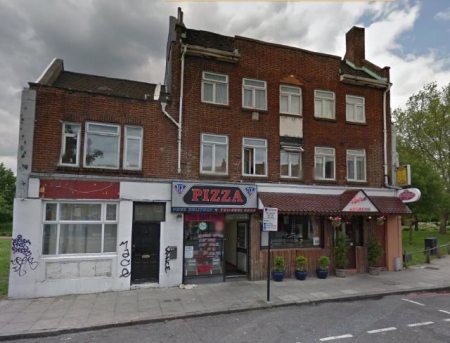
The Aunt Sally
Location of Pub- 2 Midlothian Street
Opened – ? Closed – 2000
Brewery? – Watney’s Brewery
What Is It Now? – Food Outlet
Was it known by any other name? The Outpost. The Twilight Zone.
The Melody Park Inn.
What Activities Did Pub Used To Have? Karaoke. DJ. Gay Bar.
Information so far
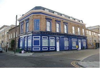
The Ordell Arms
Location of Pub- 22 Ordell Road
Opened – ? Closed – 2001
Brewery? – Courage
What Is It Now? – Residential Flats
Was it known by any other name?
What Activities Did Pub Used To Have?
Information so far
No hand-pumped beers.
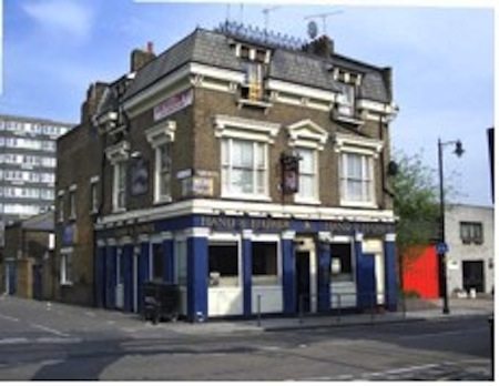
The Hand and Flowers
Location of Pub- 72 Parnell Road
Opened – 1881 Closed – 2009
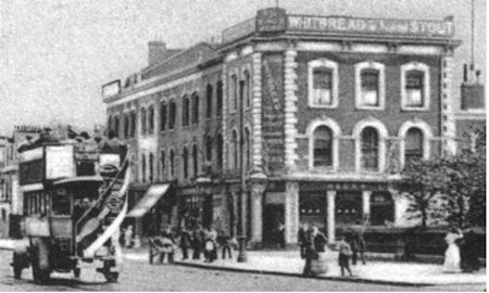
Brewery? – Whitbread
What Is It Now? – Food Outlet
Was it known by any other name?
What Activities Did Pub Used To Have?
Information so far
This pub was present by 1881 and belonged to the Whitbread Brewery. It ran into problems in 2006 when it was closed on the recommendation of police who said that a seven month surveillance revealed to them that the pub was notorious for “fights, drug-dealing and drunkenness”; this despite always looking completely deserted and harmless whenever I passed by. By 2007 the leasehold was available for £60,000 whilst the pub limped on until final closure in 2009.
The Black Swan
Location of Pub- 148 Bow Road
Opened – 1882 Closed – early 1970’s
Brewery? – Hodgson’s/Smith Garrett Breweries
What Is It Now? – ?
Was it known by any other name?
What Activities Did Pub Used To Have?
Information so far
The Black Swan was situated at 148 Bow Road. This pub was present by 1822, at which time it was almost certainly in the ownership of the nearby Hodgson’s Brewery. By 1915 the brewery had become Smith Garrett’s Bow Brewery. On the night of 23 September 1916 this pub was completely destroyed by a direct hit from a bomb dropped by a German Zeppelin in one of the very first ever air raids on London, with the loss of several lives. The Zeppelin itself was later shot down over Essex and the crew surrendered – they are said to have been the only uniformed German troops to have set foot on English soil during the First World War. The pub was rebuilt in 1920, although was from then on said to be haunted by the ghosts of the former landlord’s two daughters who had died in the air raid. The pub closed and was demolished when Bromley High Street was widened in the early 1970s.
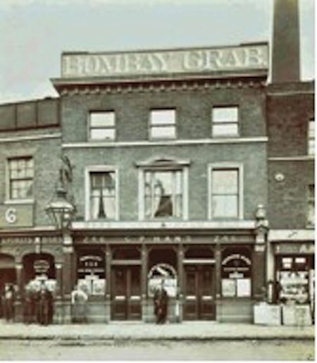
Bombay Grab
Location of Pub- 246 Bow Road
Opened – 1805 Closed – early 19792/3
Brewery? – Hodgson’s/Ind Coope Breweries/Freehouse
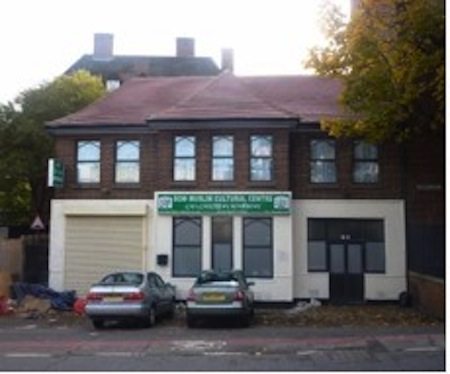
What Is It Now? – Mosque and Islamic Centre
Was it known by any other name?
What Activities Did Pub Used To Have?
Information so far
The Bombay Grab was situated at 246 Bow Road. This pub was present by 1805 and by 1817 had become the brewery tap for Hodgson’s Brewery, which had relocated to an adjacent site. Hodgson’s are of course famous as one of the pioneers of the export by sea of beer to the British colonies in India. Indeed, the name of the pub is believed to be a corruption of ‘Bombay Gurab’, a kind of Indian coastal vessel which would also have played a part in the export beer trade. The pub was rebuilt in 1933 when this whole area was redeveloped. After the Second World War, the licensee was James Charles Lane, a former champion weightlifter and wrestler. By this time the pub was owned by Ind Coope. It became a free house in around 1990 and closed very soon after, in 1992 or 1993. In these later years the pub had been quite a landmark, with its name painted on its roof in huge white letters, clearly visible from the adjacent Bow Flyover. The former pub now houses a mosque and an Islamic community centre. The Bombay Grab was the name of a specific ship in the East India Marine. The publican in 1900 was George Peter Hans, a Bavarian who took British nationality.
The Duke of York
Location of Pub- 129 Anthill Road
Opened – 1869 Closed – 2002
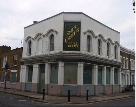
Brewery? – Smith Garrett’s Brewery
What Is It Now? – Private Residential
Was it known by any other name?
What Activities Did Pub Used To Have?
Information so far
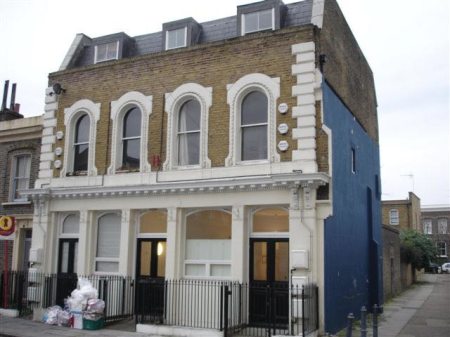
The Duke Of York was situated 129 Antill Road. This pub was built in around 1869 and was owned by Smith Garrett’s Brewery of Bow. It featured some very fine green tiling advertising that brewery’s products, some of which still survive and are almost certainly the best monument to that brewery that can still be seen today. The pub closed in 2002 and was converted to private residential use.
Moulders Arms
Location of Pub- 50-52 Bromley High Street
Opened – ? Closed – 2007
Brewery? – ?
What Is It Now? –
Was it known by any other name?
What Activities Did Pub Used To Have?
Information so far
Facing the pub about 50 to 100 metres to the left was a large house. My grandmother my grandfather my mum and her two brothers lived in this house from 1908 to 1914. There were about twelve rooms in this house and every room had a family. On the ground floor was one toilet which everyone in house had to use, but also, The Moulders arms clientele had to use it because the pub had no toilet. ( the good old days ) My mum told me that every weekend there was a continuous queue of people from the pub going past there room, relieving themselves in the one toilet whilst sing at top note for every ones enjoyment.
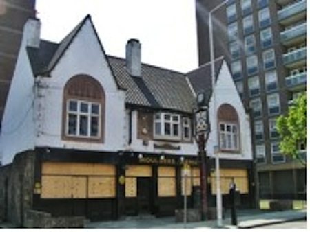
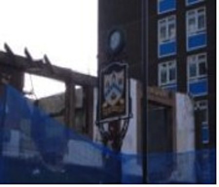
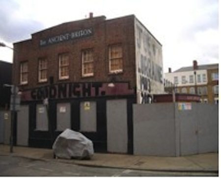
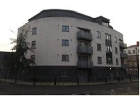
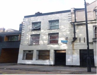
The Ancient Briton
Location of Pub- 44a Glaucous Street
Opened – 1855 Closed – 2005
Brewery? – Charrington’s Brewery
What Is It Now? – Residential Apartments
Was it known by any other name?
What Activities Did Pub Used To Have?
Information So Far
The Ancient Briton was situated at 44a Glaucous Street. This pub was built in 1855 when Glaucous Street was first developed. By the twentieth century it was a Charrington’s Brewery pub. It closed in 2005 and was demolished in 2007, with flats being built on the site.
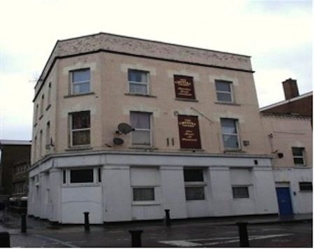
The Crystal Tavern
Location of Pub- 25 Burdett Road
Opened – 1880 Closed – 1995
Brewery? – Taylor Walker Brewery
What Is It Now? – Residential Use
Was it known by any other name?
What Activities Did Pub Used To Have?
Information so far
The Crystal Tavern was situated 25 Burdett Road. This was a Taylor Walker Brewery pub, established in around 1880. It closed and was converted to residential use in around 1995 and was demolished in 2010.
The King’s Head
Location of Pub- 8 Bow Road
Opened – 1885 Closed – 1970’s
Brewery? – ?
What Is It Now? – Demolished with strip of shops
Was it known by any other name?
What Activities Did Pub Used To Have?
Information so far
The Kings Head was situated at 8 Bow Road. The publican in 1885 was George Kemp. The pub was demolished, along with the strip of shops fronting on to Bow Road, between British and Merchant Streets, in the 1970’s.
Lady Franklin
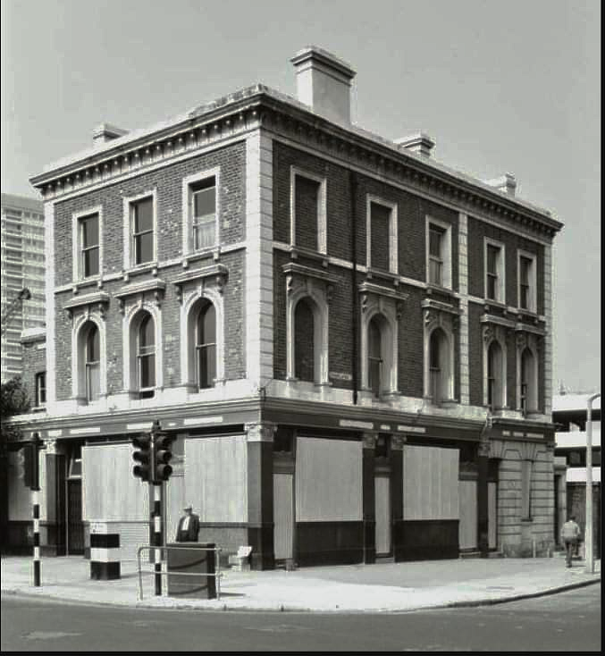
Location of Pub- 381 Old Ford Road
Opened – 1861 Closed – 1969
Brewery? –
What Is It Now? – Residential Flats above Commercial Premises
Was it known by any other name?
What Activities Did Pub Used To Have?
Information so far
Many thanks to Richard Cole for sending us the photo of the Lady Franklin. Richard said: “The old boy standing outside was the one armed paper seller George, he lived in Parnell Road a few doors down from the pub. In the six years we lived there come what may winter or summer rain or shine I never saw him wear an overcoat or take his jacket and cap off. My parents were the last tenants, this photo must have been taken just after they closed the pub down ready for demolition, I would think ‘68/69.”
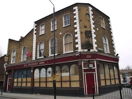
The Tenterden Arms
Location of Pub- 22 Devons Road
Opened – 1869 Closed – 2007
Brewery? – Truman’s Brewery
What Is It Now? – Residential Flats above Commercial Premises
Was it known by any other name?
What Activities Did Pub Used To Have?
Information so far
The Three Tuns
Location of Pub- 185 Bow Road
Opened – 1823 Closed – 1999
Brewery? – Hodgson’s/Whitbnread Breweries
What Is It Now? – Residential Flats above Commercial Premises
Was it known by any other name? Ye Olde Three Tuns
What Activities Did Pub Used To Have?
Information so far
The Three Tuns was situated at 185 Bow Road. This pub was present on what was then Bow High Street in 1823, at which time it was owned by the Hodgson’s Brewery of Bow. By the late twentieth century it was a Whitbread Brewery pub, popular enough to be enlarged into the neighbouring premises in 1985, and in its latter years it affected the name Ye Olde Three Tuns. But in 1999 it closed and was converted into residential use.
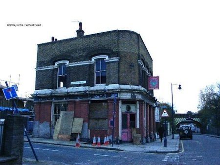
Bromley Arms
Location of Pub- 51 Fairfield Road
Opened? ? Closed – 2005
Brewery? – Watney’s/Shepherd Neame Breweries
What Is It Now? – Residential
Was it known by any other name?
What Activities Did Pub Used To Have?
Information so far
The Bromley Arms was situated at 51 Fairfield Road. This pub was present by 1861 and closed in 1997. It had been a Watney’s Brewery pub until 1989, when it was purchased by the Shepherd Neame Brewery of Faversham, Kent. It stood derelict for a while after closure, until converted to residential use in 2005.
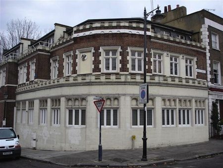
Morpeth Castle
Location of Pub- 69 Cadogan Terrace E9
Opened? 1860 Closed – 1990
Brewery? – Truman’s Brewery
What Is It Now? – Residential
Was it known by any other name? Manhattan’s/Butlers
What Activities Did Pub Used To Have?
Information so far
The Morpeth Castle was situated at 69 Cadogan Terrace. This pub was established by 1860. It was a Truman’s Brewery pub and still exhibits some brewery signage. Although at the time still owned by Truman’s, by 1983 the pub had been renamed Manhattan’s. By 1986 the name had been changed to Butlers, and the pub closed in 1990. By 1992 it had been converted to residential use.
Bridge House
Location of Pub- 14 Bow Common Lane
Opened? 1878 Closed – 2000
Brewery? – Watney’s/Bellhaqven Breweries/ Freehouse
What Is It Now? – Residential
Was it known by any other name?
What Activities Did Pub Used To Have?
Information so far
The Bridge House was situated at 14 Bow Common Lane. This pub was present by 1878. It was a Watney’s Brewery pub until around 1990 when it was sold to Belhaven. The pub closed in 2000, after a final short period as a free house, and has been converted to residential use.
The Earl of Ellesmere
Location of Pub- 19 Chisenhale Road
Opened? 1866 Closed – 2001
Brewery? – Taylor Walker/Godson’s Breweries
What Is It Now? – Residential
Was it known by any other name?
What Activities Did Pub Used To Have? Music and Dancing
Information so far
The Earl Of Ellesmere was situated 19 Chisenhale Road. This pub was present by 1866, at which time it obtained a licence for music and dancing. It was a Taylor Walker Brewery pub, although by the 1980s it stood opposite the modern-day Godson’s Brewery. It closed and was converted to residential use in 2001.
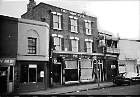
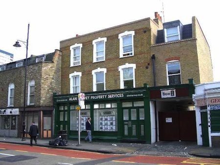
The John Bull
Location of Pub- 490 Roman Road
Opened? 1850 Closed – 1996
Brewery? – Taylor Walker Brewery
What Is It Now? – Estate Agents
Was it known by any other name?
What Activities Did Pub Used To Have? Music and Dancing
Information so far
The John Bull was situated at 490 Roman Road. This pub has stood on Roman Road since at least 1850. It was a Taylor Walker Brewery pub and, despite always seeming busy, it closed in 1996. The premises now serve as an estate agent’s offices.
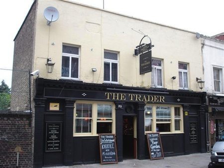
The Needle Gun
Location of Pub- 215, then 527 Roman Road
Opened? 1828 Closed – 2011
Brewery? – ?
What Is It Now? – Hotel
Was it known by any other name? The Trader
What Activities Did Pub Used To Have?
Information so far
The Needle Gun was at 215 Roman Road but it later became 527 Roman Road through road renumbering. The pub was established in 1828 and in recent years was renamed the Trader (2007). By 2011 the pub had become a hotel .
The Lord Palmerston
Location of Pub- 45 Hewlett Road, Old Ford Road
Opened? 1866 Closed – 2002
Brewery? – Charrington’s
What Is It Now? – Residential
Was it known by any other name?
What Activities Did Pub Used To Have?
Information so far
The Lord Palmerston was situated 45 Hewlett Road. This was a quiet, backstreet Charrington’s Brewery pub, established by 1866. It closed in 2002 and has been converted to residential use.
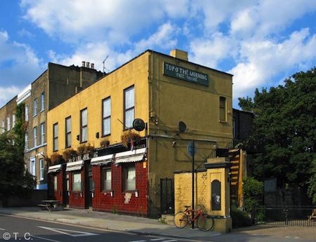
Top O’The Morning
Location of Pub- 62 Frances Terrace, Wick Lane then 129Cadogan Terrace E9
Opened? 1864 Closed – 2013
Brewery? – ?
What Is It Now? – ?
Was it known by any other name? Mitford Castle
What Activities Did Pub Used To Have?
Information so far
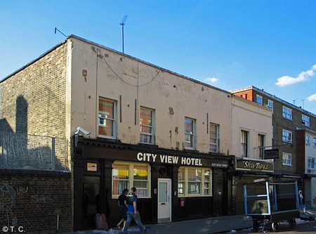
Mitford Castle The pub was present by 1864 at 62 Frances Terrace, Wick Lane in 1878. Later address is at 129 Cadogan Terrace. It had been named Top O’ The Morning since at least 1983. Closed as a Pub by 2013, although possibly earlier.
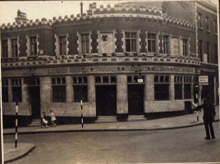
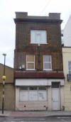
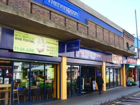
The Matchmaker
Location of Pub- 580-586 Roman Road
Opened? ? Closed – 2010
Brewery? – Freehouse (Wetherspoons)
What Is It Now? – Poundland
Was it known by any other name?
What Activities Did Pub Used To Have?
Information so far


Hello Jennifer
What a lovely surprise. I have tried unsuccessfully to find you on facebook. Please contact me on my e.mail.
maureendinks@hotmail.com.
Where have the years gone. Briefly, we live in Welwyn in Hertfordshire. As you know we had Lorraine, then Lisa and then Billy. Four grandchildren and two great grandchildren. Remember Andy’s opposite Stepney Green station. Please get in touch Jen and we can catch up.
Love
Maureen Copeland nee House
Hi I went to Edinburgh Castle club and went on trip to Stratford upon Avon with them. Can you post pictures. My Aunt Rose had a Grocers shop in Timothy Rd opposite Shackladys and My Mum went on Shackladys I lived in Turners Rd
Hello to all interested in Timothy Road. I found two pub Beano Outing photos for Shackladys, and also one for an Edinburgh Castle women’s group (does anybody remember this Methodist Church, just round the corner in Rhodeswell Road) in ” Cockney Beano Booklet 2013″. Maureen, I spotted your Mum, your Nan and your cousin Linda’s Mum in the beano photos. Who else can you recognise I wonder!
Hi Ken
I was born in 1943 and I also sat in the back room of Shackladys. I remember the Perkins family. They were either next door or next door but one. The Hawkes family were next door to them and Ria Ward was next door to that. I was friends with Rita Hawkes. I remember watching them dance in Shacks after they had played shove halfpenny. I used to look at a couple from the perkins family dance. They might have been your mum and dad. She had very dark hair.Rose Shackllady used to give me sweets.
An answer for Maureen Copeland. Shacklady’s was the St Dunstan’s Arms 48 St Dunstan’s Road which was re named Timothy Road—don’t know when. I was born in 1946 & my Dad’s parents lived next door or next door but one at no: 52. We moved away in 1958 but I well remember going to the back room of the pub while the family were having a drink. I think the landlord was Ted Shacklady. It was my Grand dad’s second home!! I remember the flats & there was a school over the back.
Hi Maureen. Yes that was my Mum. Every one called her Aunt Rose although she was my Great Aunt. I remember all the names too. I went to Daglish St(Sir William Borough) then Martin Frobisher.
hi.does any body remembers the Kenton arms pub. mum used to lodge next door about 1935 is it still there.
My Grandma was licensee of The East London Stores Crisp St E14
A beer, wine and cider house, that must have been unusual.
About 1944, she moved to The Harry Tavern, Brunswick Road about 1950. She died in 1959 . My Dad was licensee of The Crown and Cushion ,Farnfield St, Poplar from about 1944 /1949, The Newcastle Arms Isle of Dogs From 1949/ 1960 and The Harry Tavern from 1959. All Taylor Walkers.
Oh my goodness! Lotte Reynolds was a big blonde lady. She helped Aunt Rose in the shop. Next door lived the Wrens, loads of them and along Timothy Rd there were the Wisbeys, Stiffles, Mrs Clutterbuck,Ada Mahoney and lots of them I can’t remember names of. We used to stand in Turners Rd to watch the catholic procession.I went to school in Seager Place off of Burdett Rd and then on to Coborn.So many memories
Hi Maureen.
That was my Mum Lottie. My single name is Reynolds. We lived in Turners Rd
If the Earl of Zetland was the pub in Burdett Road just before the railway bridge then yes I do remember it. A friend of mines parents either ran or managed it, this would have been about 1962 – 63. It had a very large room on the first floor that a group of us used to gather in and play records and a couple of them used to practice guitar playing. It had a garage attached to it and my friends father said if we painted it inside (whitewashed it) we could strip down any cars we bought for any repairs. Well we did whitewash it but we never did buy any cars. Strange how relating something like this can suddenly bring back the memory of a smell, I can distinctly remember the smell of whitewash as I type this.
Yes. It was owned by Fox family, went out with Son Johnny. My sister and brother in law drank in there
Does anybody remember The Earl of Zetland in Burdette Rd.I had my wedding reception in there in March 1962.
Hi Gloria
I remember Rosie Burke.I went in there every day.There was also a lady called Lotte there.I can picture them all now.What a gossip shop it was
Hi Maureen I remember it too. My Mum would go on the outings.. My Aunt Rose & Uncle Jim Burke owned the grocery shop on the other side of the road.
Yes I remember Roger Clarke. His mum and dad were Annie and Ernie Clarke. We lived at No 6 and they were No 8. They all came to my wedding in 1962. That’s when I left.
Hi Maureen. I don’t remember the pub, but do remember Pauls house. My friend Roger Clarke lived there in the late 1960. They moved when the stadium claimed the land.
Does anyone remember a little pub in Timothy rd Bow. We never knew the correct name but we called it Shackladies after the brother and sister that ran it, It is all Mile End park now. We lived I Pauls House, a little block of flats next door
Ok Kathleen, thank you for the reply. I thought you may have been one of the Noble family who lived opposite the corner shop, I myself lived in Lichfield road from 1947 – 1970. Gordon Noble was a server at Holy Trinity church as was my brother who is now 78.
Large family? Yes, Alan. ….. No to the posh wine waiter though!